Note:
Antelope Island State Park used to be one of my favorite locations in northern Utah. Due to pipeline construction along the causeway to the island, construction on the island itself, plus areas that were birdy being restricted now, and negative impacts caused by climate change, I truthfully can’t say that anymore. Your preferences may vary.
Antelope Island State Park is was another of my favorite locations for bird and wildlife photography plus the scenery is incredibly beautiful at any time of the year. Although the park is about 41 miles from Salt Lake City it has retained its wild and wonderful character.
This will be a series of three posts on the scenery, wildlife and birds of Antelope Island with loads of images and my thoughts about this jewel that is surrounded by the Great Salt Lake. I’m adding links to some sections of this series for additional information because I will be writing this from my impressions and perspective of the island, its inhabitants and the year round beauty that beckons to me.
The Scenery of Antelope Island:
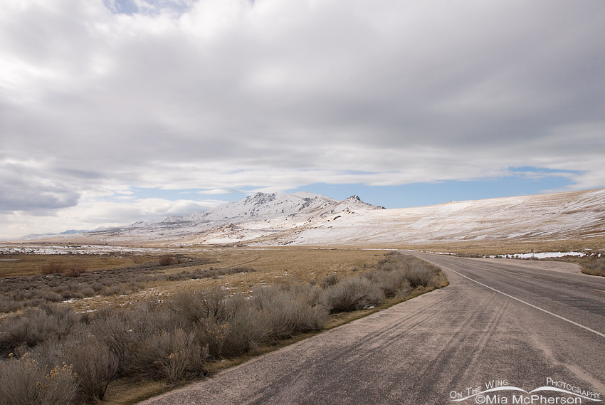 View of Frary Peak ~ Elevation 6589 feet – Nikon D200, f8, 1/1250, ISO 400, Nikkor 18-200mm VR at 18 mm
The first time I visited Antelope Island was in 2008 and almost immediately knew that I wanted to visit over and over again so that I could explore it in depth. I wanted to know its geology, history and what it looked like in every season of the year. I wanted to become familiar with the birds, wildlife and plants that call the island home. I wanted to see sunrises, sunsets, feel the lake fog on my skin and watch as the wind swept through the grassy prairie and see snow covering the craggy rocks of Frary Peak.
Antelope Island has some of the oldest rocks in the United States dating from the Precambrian period 2.7 billion years ago to youngest which are Tufa formed 10,000 to 15,000 ago.
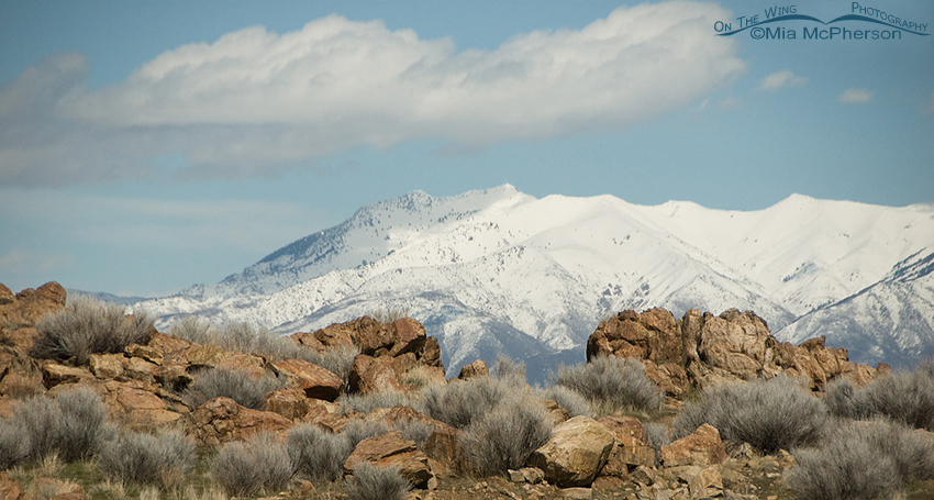 View from Frary Peak parking area across to the Wasatch Mountain Range – Nikon D200, f6.3, 1/6400, ISO 400, -0.3 EV, Nikkor 18-200mm VR at 170mm
From different areas on the island the views are incredible, you can see for miles and that includes being able to see several different mountain ranges. I was about half way up Frary Peak at the parking area when I took the image above, below the rocks in the foreground it drops off quickly then goes down the slope to the shoreline of the Great Salt Lake, from where I stood it is a long distance to the Wasatch Mountain Range shown in the background.
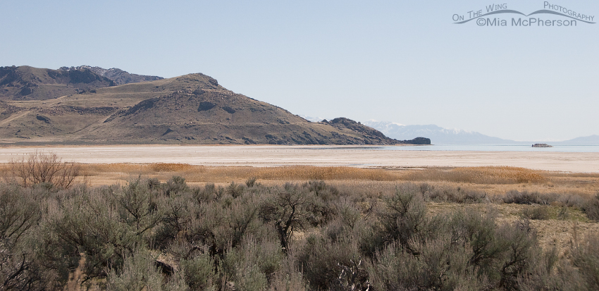 View of White Rock Bay on Antelope Island – Nikon D200, f6.3, 1/4000, ISO 400, Nikkor 18-200mm VR at 44mm
Around the shoreline of the island there are marshy areas where Cattails and Phragmites grow, even though the lake is saline areas like this marshy area shown here can thrive due to fresh water run off from snow melt, rain and springs. The area is called White Rock Bay due to the small rocky island near the right side of this frame. It may look a bit dark in this image but in the right light is does appear to be white.
This image also shows several “benches” on the hillside to the left of White Rock, the benches were created when the lake level fell and that created a sandy shelf area called a “bench”. Taken at the end of March this photo shows that the vegetation present had not yet started to grow and green up. The island can be very lush and green during the spring.
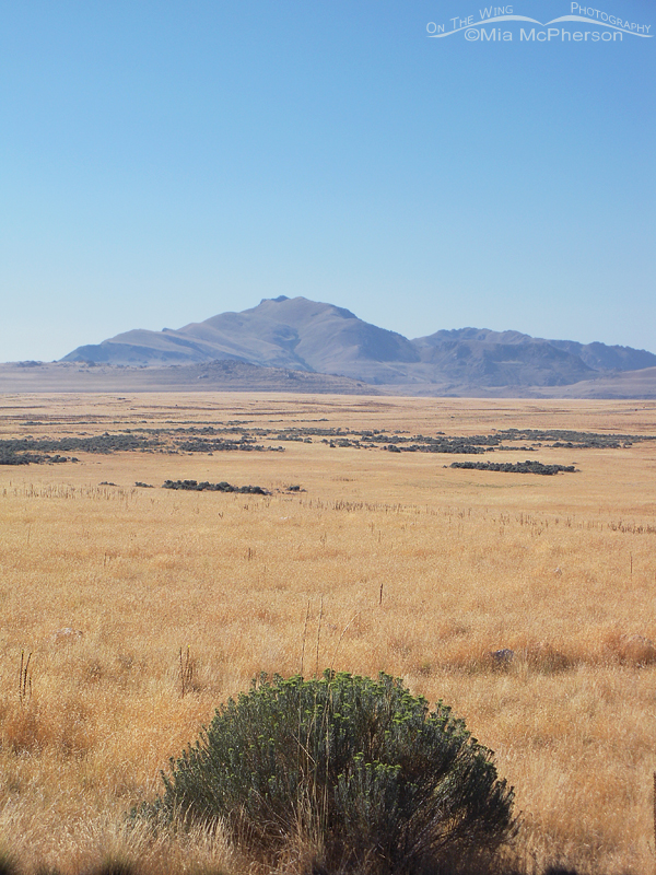 View from the north end of the island south towards Frary Peak – Nikon COOLPIX S550, f4.8, 1/432, ISO 64, 14mm
When the summer heat arrives the grasses turn to soft golden shades that contrast deeply from the darker Sagebrush and Rabbitbrush that are found all over the island. The grasses create a whispering sound when the wind blows over them which I quite enjoy hearing.
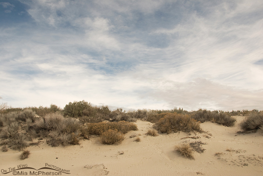 Oolitic sand dunes on Antelope Island State Park – Nikon D200, f11, 1/500, ISO 400, Nikkor 18-200mm VR at 18mm
There are sand dunes located at the north end of the island by the beach area. The sand found on there is quite different from sand that many people are used to on the Atlantic and Pacific coasts, oolitic sand is much lighter in weight and the process by which it is formed is vastly different from other sand. Oolitic sand is formed with the Great Salt Lake where the process begins with a core or nucleus of brine shrimp fecal pellets or tiny mineral fragments that are moved under the water by wave action, As these pellets or fragments are pushed along calcium carbonate begins to collect on their exteriors in concentric layers like nacre forms on pearls. Because of the continuous wave motion the oolitic sand form tiny grains that look like eggs.
Oolitic sand fascinates me.
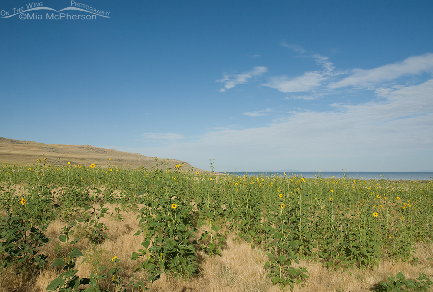 Wild Sunflowers near the Bridger Bay Campground – Nikon D200, f16, 1/160, ISO 320, +0.7 EV, Nikkor 18-200mm VR at 18mm
Summer on the island also has gorgeous views of fields of wild Sunflowers and in other areas the spikes of Moth Mulleins with their tiny golden flowers. The spring of 2011 was very wet and cold and that seemed to have benefited the wild Sunflowers because I had never seen them as thick or as tall as they were last summer.
This fall and winter I have cursed them because the over abundance of the dried stalks make it difficult for me to get clear shots of the animals and birds on the island in some areas.
 Wild Common Sunflower (Helianthus annuus) blossom
However; when I look at my images of those wild Sunflowers with their sunny yellow petals and soft brown centers I can not curse them for long. They are just so pretty.
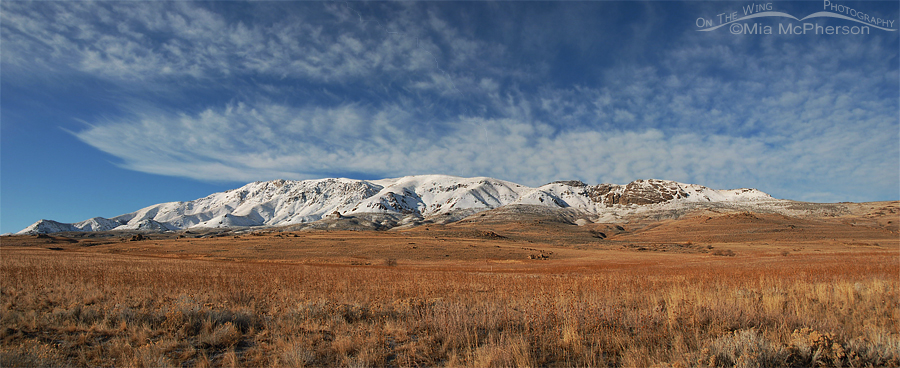 Antelope Island Mountains ~ January 22, 2012 – A three-frame panoramic merge – Nikon D200, F7.1, ISO 100, 18-200mm at 20mm
After days of gray clouds, wind and rain this is a view I saw out on the island yesterday. Beautiful sky, snow covered mountains, the golden tones of dried grasses, crisp cool air. I’m so lucky to live nearby.
Antelope Island State Park WAS wild and wonderful.
Mia


this place is beautiful I’ve lived here my whole life and never gone. You have inspired me to go and just take it in. I’m excited to bring my camera and see what can come out of it there.
Magical Place!
It sure is Judy!